


Google Photos is one of the most useful apps for storing, sorting, searching, and sharing all of the photos and videos you capture on your smartphone — but if you travel, it just got a lot more useful.
After a recent redesign, Google has reorganized the app's existing features and added a neat new one called Map View. The most-requested new feature from user feedback, Map View lets you explore your visual history of photos and photos via a heat map. Here's how to access it.
Update Google Photos
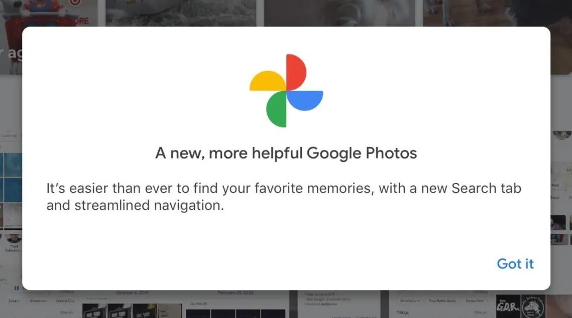
You're looking for version 5.0 of the app, which brings along with it a revamped logo. Now, there's a chance that, even with the update installed, that you won't get the new interface or features. The update dropped on June 25, but I didn't get the revamped version on my Google Pixel 4XL until the following Monday.
You'll know when you see a welcome message like the one below. Tap "Got it" to dismiss the message and continue.
Jump to Search
After dismissing the welcome, you'll see the redesigned Photos page, where the Memories have changed from circles a la Instagram's Stories to rectangles in the vein of Facebook's Stories, but the chronological grid remains the same.
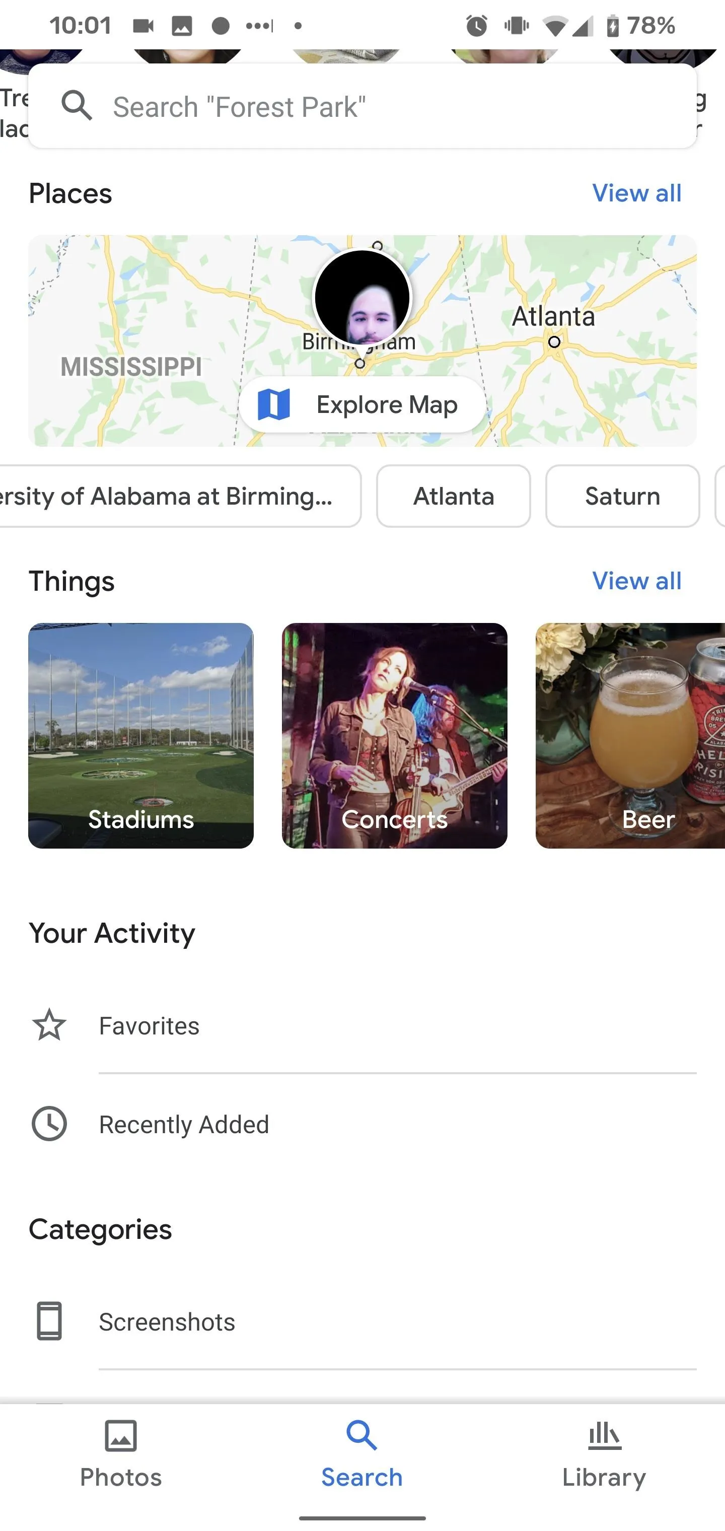
You'll also notice that the navigation tabs have changed from Photos, Albums, For You, and Sharing to Photos, Search, and Library. Tap "Search" to proceed to access the map.
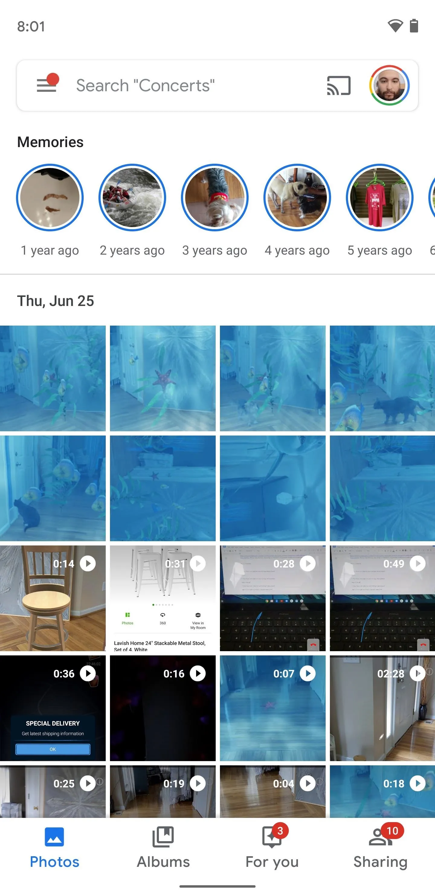
The old Photos UI has circular Memories thumbnails and four navigation tabs.
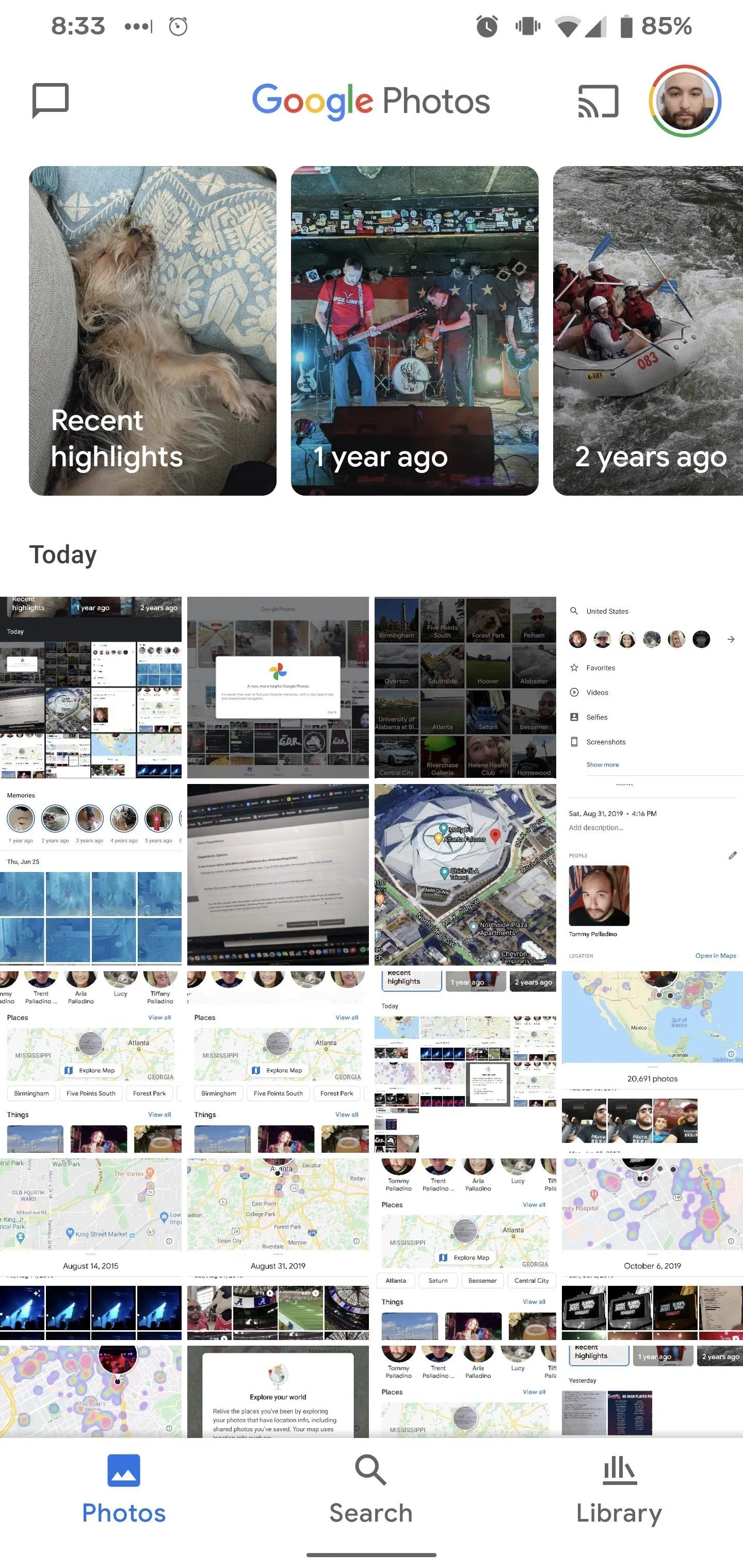
The new Photos UI has rectangular Memories covers and three tabs.
The old Photos UI has circular Memories thumbnails and four navigation tabs.
The new Photos UI has rectangular Memories covers and three tabs.
Explore the Map
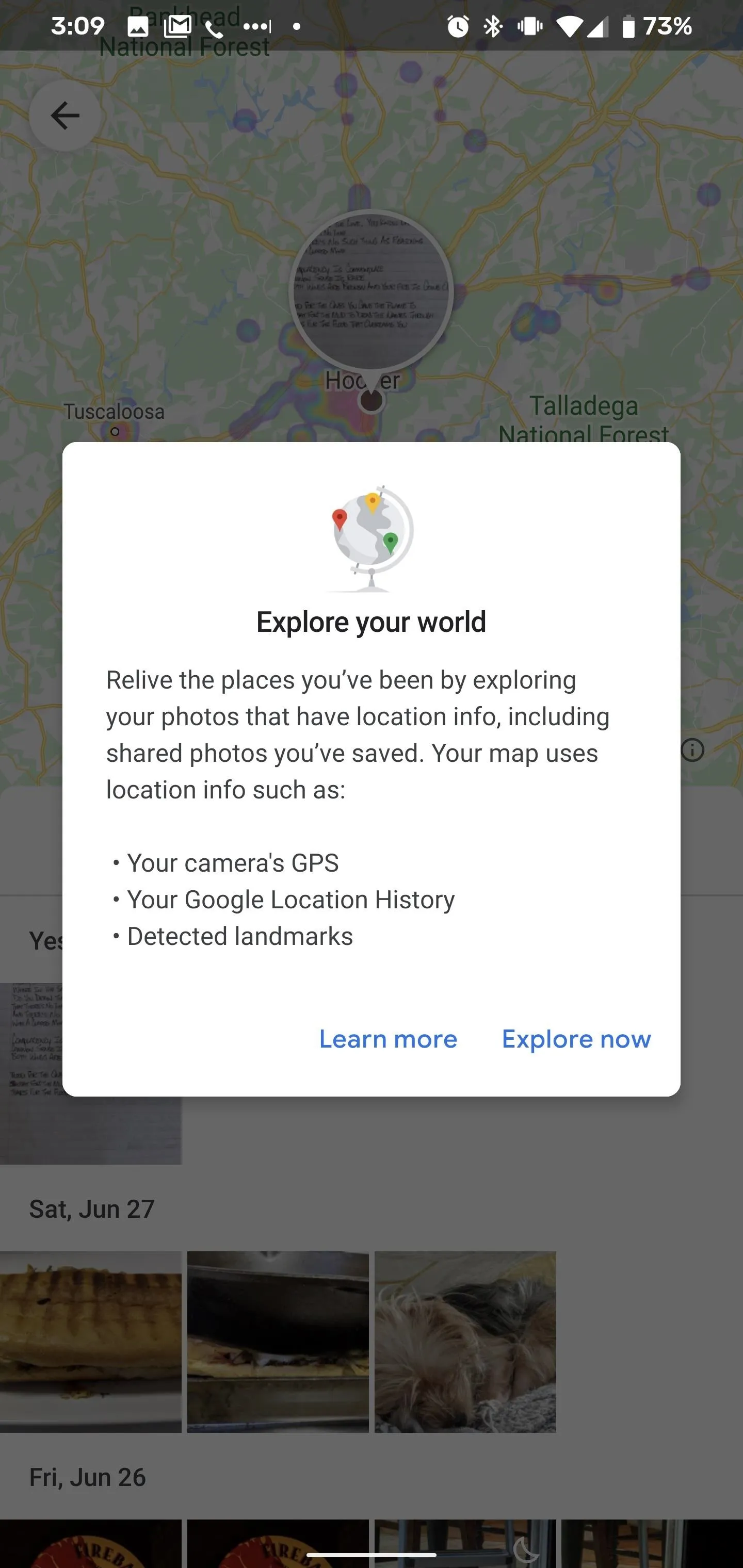
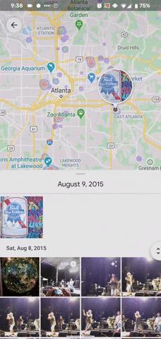
Places is the second section down on the Search page, right under People & Pets (I've scrolled down for the privacy of my People & Pets). Tap on the map to open up the region of your densest concentration of photos and videos (your first time through will present a dialogue box explaining how Map View works; more on this later). You can also scroll through the list of your most-photographed locations and select one to open the map view over more specific areas or search for more obscure locales via the search bar.
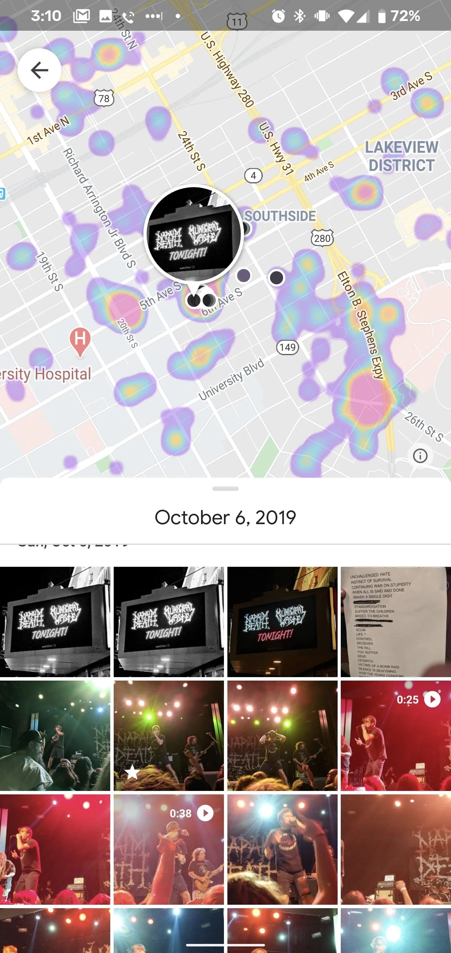
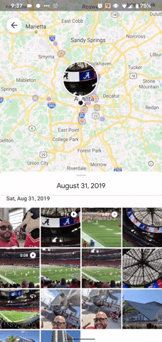
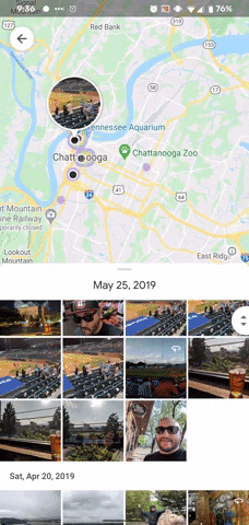
Either way, you'll find a heat map on the top half of the screen with a grid of photos organized by date below. In landscape, the map appears to the left with the grid to the right.
Tap on the heat marks to jump to the most recent photo in that area, which will be marked by a location pin with a thumbnail of that image, or scroll through the grid to watch the location pin jump from place to place. You can open photos both via the pinned thumbnail or the grid. You can use pinch gestures on the map to adjust the scale of the visible area.
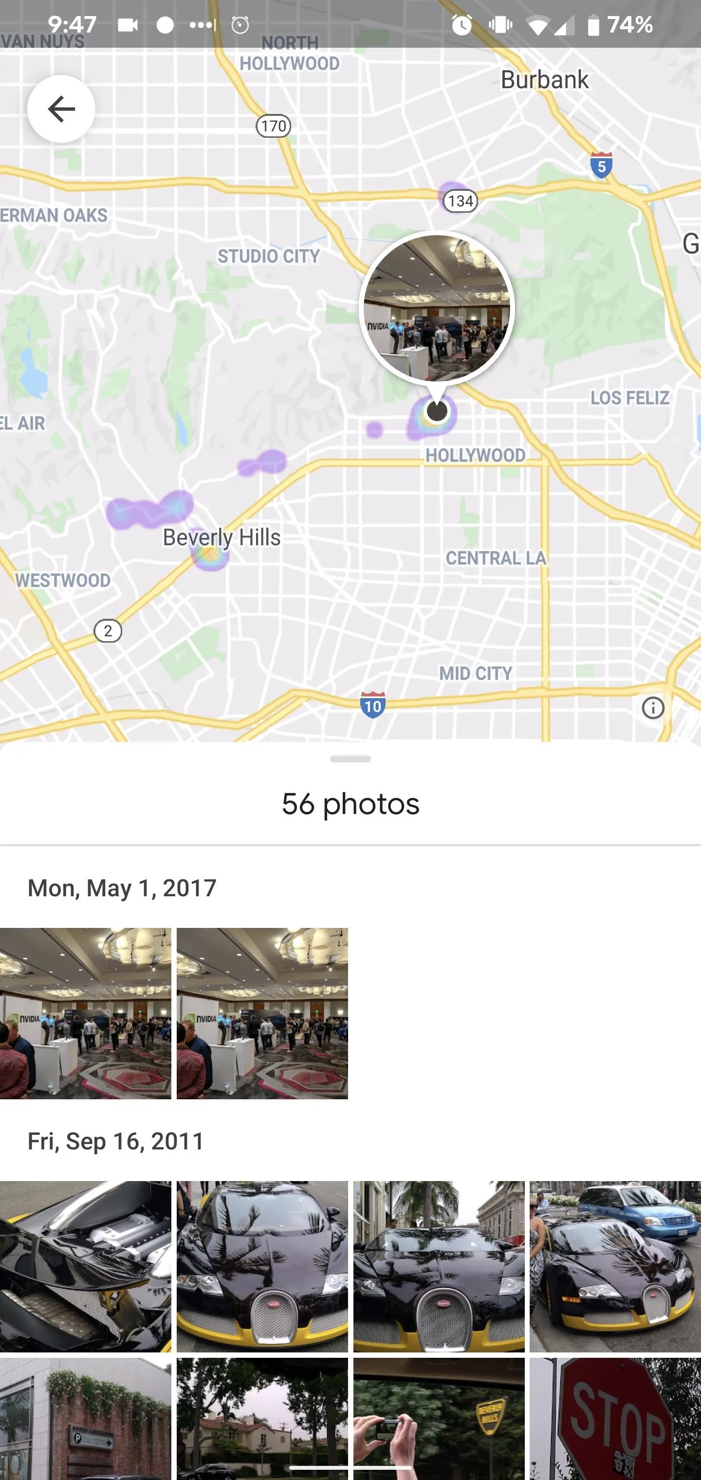
This feature depends on location data, either from metadata embedded into your photos from your smartphone camera or from your own manual entry or estimates of your whereabouts from Google Location History or landmarks.
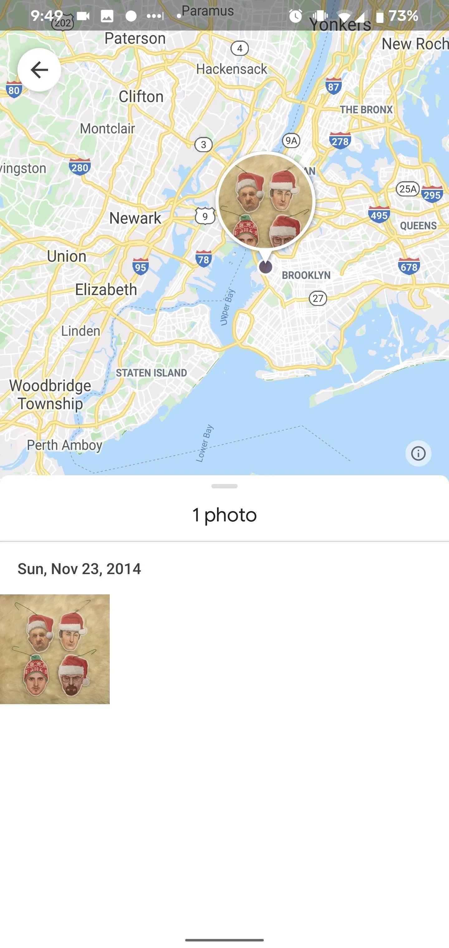
In addition, photos you save from elsewhere on the web that maintain their location data will show up in their location of origin. For example, I did not visit Los Angeles in 2017, but photos shared with me from a conference there are pinned there. I have also never been to Brooklyn, but I've downloaded an image from Reddit that was created there.
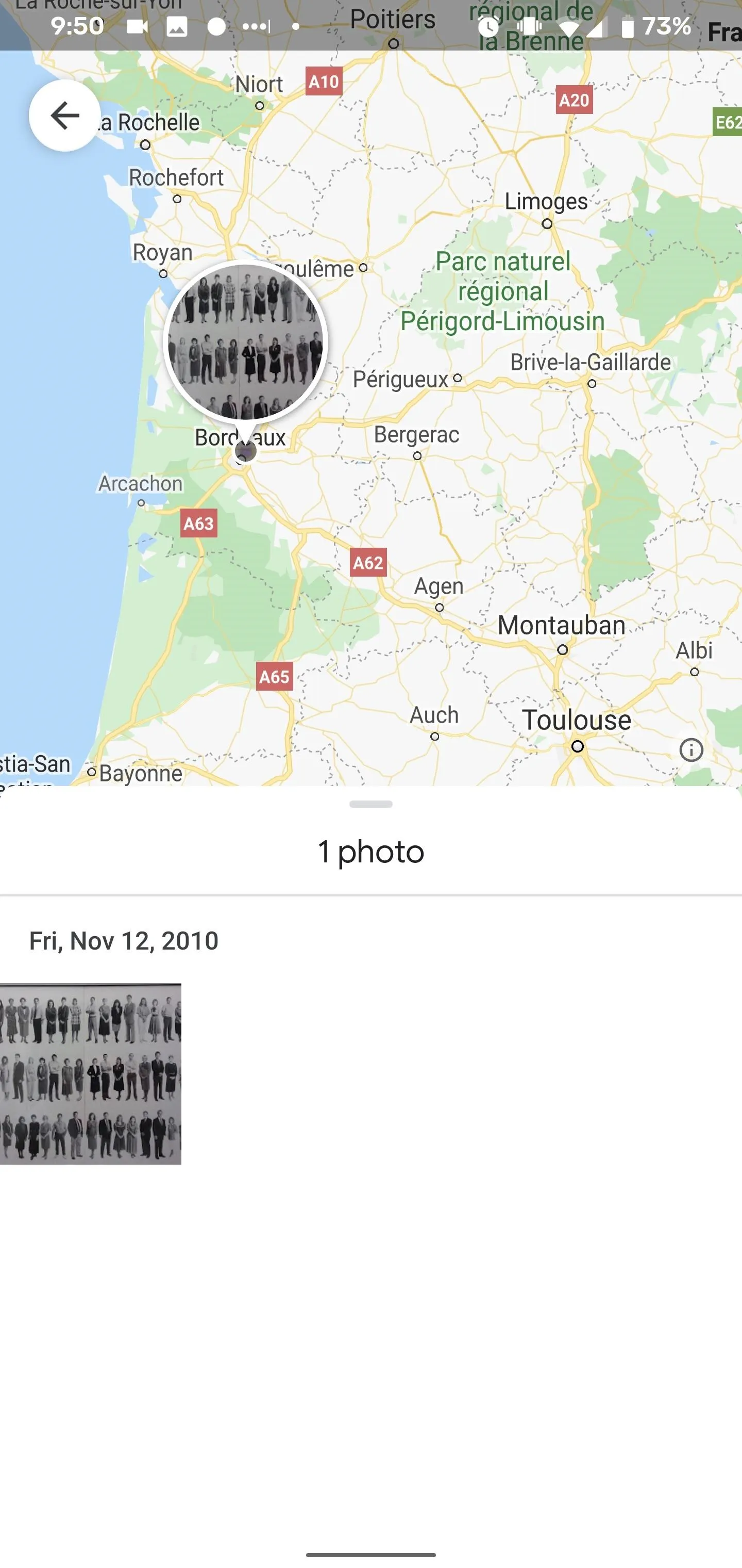
However, these location parameters do not explain how a photo I took at a former workplace, with no discernable landmarks, shows up in Bordeaux, France. Rather than inquire further, I'll follow the advice of Iris DeMent and "Let the Mystery Be."
Cover image, screenshots, and GIFs by Tommy Palladino/Gadget Hacks


Comments
Be the first, drop a comment!